Urban Park Detail AutoCAD Drawing with Landscape Layout and Zones
Tags
Ratings & Reviews
Be the first to share your experience with this product. Your review helps others make better decisions!
Description
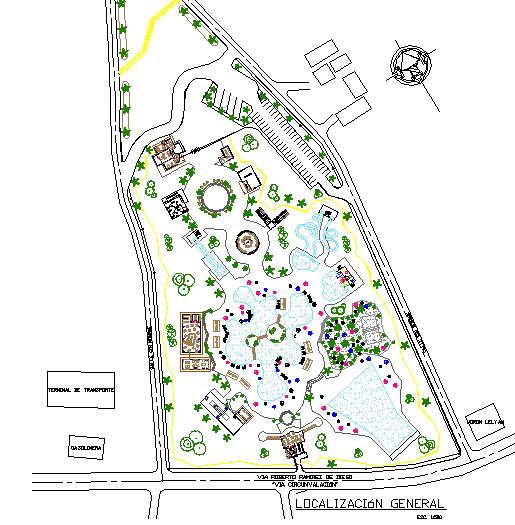
This Urban Park Detail AutoCAD drawing presents a comprehensive landscape planning layout with clearly defined recreational and functional zones. The drawing illustrates the overall park boundary with internal circulation paths, landscaped green areas, water features, seating zones, activity spaces, and built structures arranged within the site. Pathways, open lawns, tree plantations, and focal elements are accurately drafted to scale, providing clarity on spatial organization and land use. The layout also indicates entry points, pedestrian movement flow, and designated activity areas, supporting effective urban park planning and design coordination.
The Urban Park Detail DWG file includes organized layers, precise line work, and readable symbols that allow professionals to understand and modify the design easily. It is suitable for architects, civil engineers, landscape designers, and planners working on public open space development or park design projects. The AutoCAD format ensures compatibility with AutoCAD and other supported design software for further detailing or presentation. Available through a cadbull.com subscription, this drawing helps users save design time while maintaining accuracy in landscape planning, site zoning, and urban park layout documentation.

Uploaded by:
john kelly
Tags
Ratings & Reviews
Be the first to share your experience with this product. Your review helps others make better decisions!